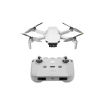
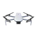
Agricultural drones now do far more than take crop photos. They support mapping, stand counts, crop-health analysis, targeted spraying, seeding and forest restoration, but the aircraft is only one part of a compliant data or application workflow.
to see more of our trusted coverage when you search.

The quick answer
Use mapping drones when the goal is measurement and scouting. Use an agricultural application drone only when the payload, crop, operator certification and chemical-label requirements all align. In the United States, dispensing chemicals or other substances for agriculture can trigger FAA Part 137 requirements in addition to Part 107.
What agricultural drones do
- RGB mapping for orthomosaics, plant counts and visible damage.
- Multispectral imaging to compare crop vigor across dates and management zones.
- Thermal inspection for irrigation patterns, livestock checks and infrastructure.
- Targeted spraying or granular application with purpose-built payload systems.
- Seeding and restoration trials in terrain that is difficult or unsafe for ground crews.
A drone does not diagnose a crop by itself. Useful programs use calibrated sensors, consistent altitude and lighting, ground truth and a repeatable analysis method. A colorful vegetation map without field validation can lead to confident but wrong decisions.
Tree planting and seeding drones
Tree-planting concepts commonly use a two-stage workflow: survey the site, then deliver seeds or seed pods to selected locations. The drone can improve access and create a digital record of where material was placed. Germination, species selection, soil contact, moisture and follow-up care still determine whether restoration succeeds.
For farms, the same principle applies to cover-crop or spot-seeding experiments. Start with a measured trial plot, compare emergence against a conventional method and calculate the real cost per established plant, not merely the number of seeds dropped.
U.S. rules for spraying and dispensing
The FAA states that Part 137 governs aircraft operations that dispense or spray substances intended for agricultural plant nourishment, treatment or pest control. Operators may need an agricultural aircraft operator certificate, aircraft exemptions or approvals, remote-pilot credentials and state pesticide licensing. The chemical label, local environmental rules and worker-protection requirements also matter.
In May 2026 the FAA published a streamlined Part 137 certification process for certain drone operators. That does not make application drones unregulated. Confirm the current federal and state process before quoting work or buying a spray platform.
How to plan a useful farm-drone program
- Define one decision the flight should improve, such as locating blocked irrigation lines.
- Choose the sensor and ground sampling distance required for that decision.
- Create consistent flight plans and preserve calibration information.
- Verify findings in the field before acting on an index or model output.
- Store data with clear field, date and treatment labels.
- Measure labor saved, input reduced or yield risk avoided over a full season.
When is a drone worth the investment?
A mapping drone is often easiest to justify where acreage, terrain or repeat surveys make walking inspection slow. Application drones require a larger compliance, maintenance and logistics commitment. Many farms should first hire an insured specialist for a pilot project, then buy equipment only after the workflow proves its value.
About this update: This guide was substantively rewritten with current FAA and USDA material. It provides general information, not legal, pesticide-label or agronomic advice.